Day Trips & Excursions From Beijing
Hiking Near Beijing: Ten Walks From Half a Day to a Summit
Wild Great Wall traverses, alpine meadows above 2,000 metres, limestone gorges and the western hills — with how to reach each trailhead and what the paths are really like.
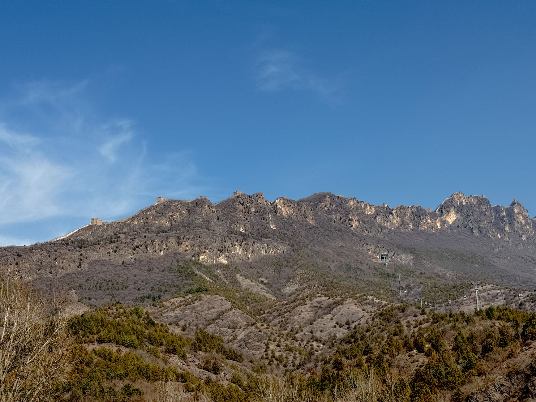
Most visitors leave Beijing convinced the city is flat. It is — the plain runs south and east for hundreds of kilometres — but turn ninety degrees and the Yan and Taihang ranges rise straight out of the suburbs, and within ninety minutes of the Fifth Ring Road you can be on a ridge at 1,500 metres with nothing man-made in sight except a ruined watchtower. The good hiking near Beijing is not a compromise or a consolation prize for a city break; there are alpine meadows above 2,000 metres, limestone gorges, monastery valleys and about six hundred kilometres of unrestored Great Wall, and on a weekday you will have most of it to yourself.
This guide covers the walks worth doing by difficulty and season, how to reach them without a car, what the trails are actually like underfoot, when the weather and the air make them unpleasant, and which famous ones are not really hikes at all. Prices were checked in September 2026; treat them as the right order of magnitude rather than a quotation.
The short answer
If you have half a day, walk the Fragrant Hills or Badachu on the western edge of the city — both reachable by subway and bus, both essentially paved staircases with temples on them. All of these are day trips in the ordinary sense, and the wider day-trip guide sets them against the non-walking alternatives.
If you have a full day and want a real walk, go to the Great Wall: the Gubeikou to Jinshanling traverse, or Jiankou to Mutianyu if you are confident and take a guide. This is what the mountains north of Beijing are for.
If you have a full day and want mountains without the Wall, Yunmeng Mountain in Miyun or Baihua Mountain in Mentougou. Baihua’s summit meadow, at around 2,000 metres, is the most surprising landscape within the municipality.
If you want the highest point in Beijing, that is Lingshan — also called Dongling Mountain — at 2,303 metres, 120 kilometres west in Mentougou. It is a long day and worth one. Further out again, Chengde pairs mountain temples with real walking, and Longqing Gorge has a short canyon route at the end of the boat ride.
The walks, compared
| Walk | Distance | Difficulty | Travel from centre | Best season |
|---|---|---|---|---|
| Fragrant Hills (Xiangshan) | 4–6 km | Easy, all steps | 1 hr, subway + bus | Late Oct for red leaves |
| Badachu | 5 km loop | Easy to moderate | 1 hr | Spring and autumn |
| Miaofeng Mountain | 8–12 km | Moderate | 1.5 hrs | Apr–May, Sep–Oct |
| Gubeikou to Jinshanling | 10 km | Moderate | 2.5 hrs | Sep–Nov |
| Jiankou to Mutianyu | 7 km | Hard, exposed | 2 hrs | Sep–Oct, dry only |
| Yunmeng Mountain | 8–14 km | Moderate to hard | 2 hrs | May–Oct |
| Baihua Mountain | 10–14 km | Moderate to hard | 3 hrs | Jun–Sep for meadow flowers |
| Lingshan (Dongling) | 12–16 km | Hard | 3–3.5 hrs | Jun–Sep |
| Shidu, Fangshan | Variable | Easy to moderate | 2 hrs by train | Apr–Oct |
| Cuandixia valley walks | 5–10 km | Easy to moderate | 2 hrs | Apr–Nov |
Close to the city: half-day walks
Fragrant Hills
Be clear about what this is. Xiangshan is a former imperial hunting park on the western edge of Haidian, and the route to the summit — Incense Burner Peak, at 557 metres — is a well-made stone staircase with pavilions, tea stalls and a chairlift running alongside it. It is a pleasant walk in the woods with a view over the city at the top. It is not a mountain hike, and anyone arriving in boots expecting one will be disappointed.
Where it earns its reputation is the third and fourth weeks of October, when the smoke trees turn scarlet and the whole of Beijing comes to look at them. That is genuinely beautiful and genuinely unbearable at weekends — think a queue on the staircase. Go on a Tuesday, go at opening, or go a fortnight either side of the peak.
Getting there: subway Line 10 to Bagou, then the Western Suburban Line tram to Xiangshan, or bus 331 or 563. Entry is a few yuan; the chairlift costs extra.
Badachu
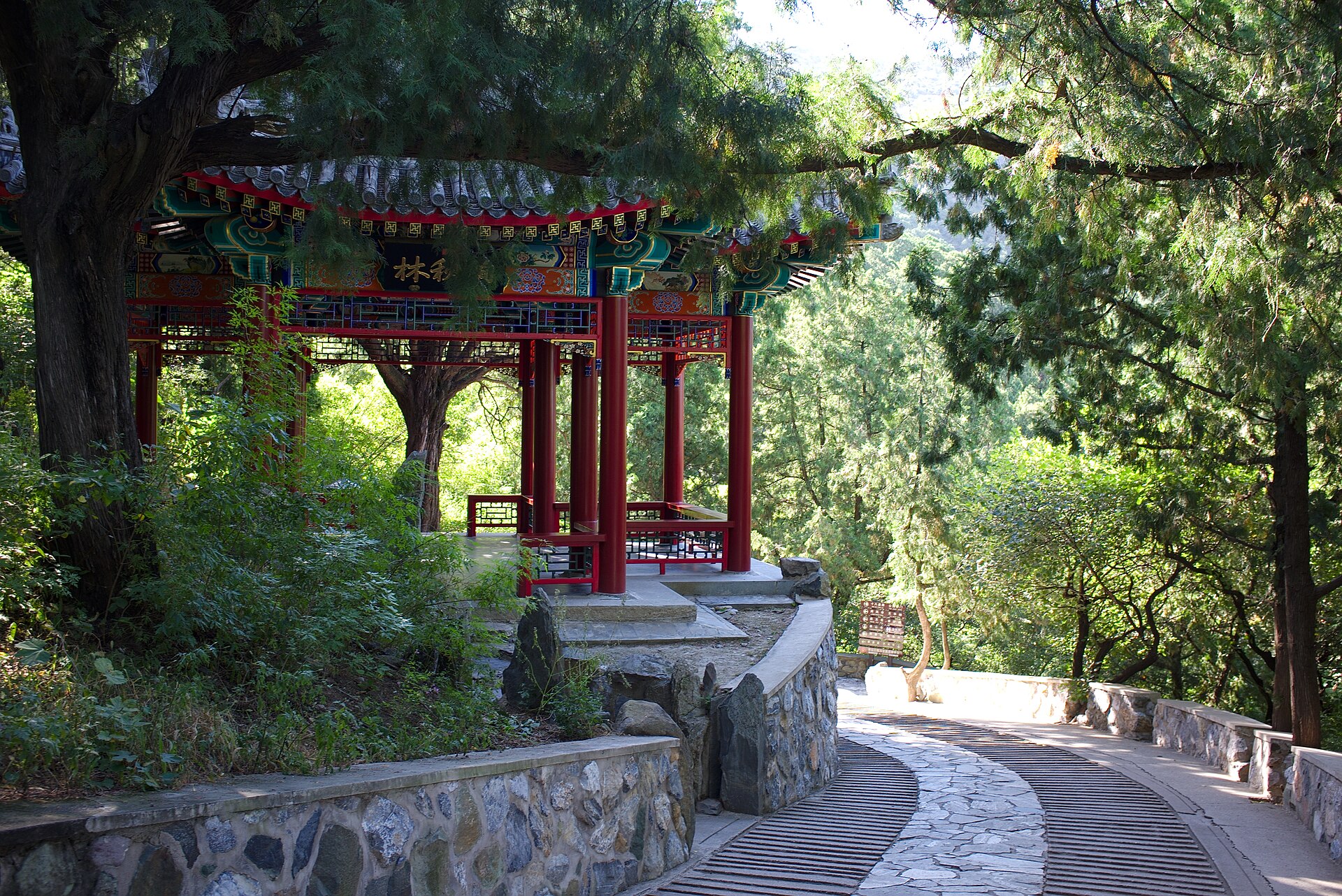
The Eight Great Sites, in Shijingshan just south of Xiangshan, is a wooded valley with eight temples strung up the hillside and a path linking them. About five kilometres round, mostly steps, and considerably quieter than Xiangshan at every time of year. There is a toboggan slide down for anyone who wants one. It works well as a half-day when the air is good and you do not want to commit to a long drive.
Miaofeng Mountain
North-west in Mentougou, Miaofengshan is a pilgrimage mountain with a temple complex at 1,300 metres and a long-established walking route up. It is a step up in seriousness from Xiangshan — a proper eight to twelve kilometres with real ascent — and it sees almost no foreign visitors. The temple fair in the fourth lunar month brings crowds; the rest of the year it is quiet.
The Great Wall as a hiking route
The best walking within reach of Beijing is on the Wall, and specifically on the parts of it nobody has restored. Two routes are the established classics.
Gubeikou to Jinshanling
Roughly ten kilometres, four to five hours, starting on genuinely wild wall at Gubeikou and finishing on the partly restored towers of Jinshanling. Part of the route drops off the wall and through a valley because a section remains under military control — follow the marked detour and do not improvise. The going is uneven, with loose brick and overgrown stretches, but there is no serious exposure. Moderate fitness is enough, and you may not see another walker for an hour.
Jiankou to Mutianyu
The famous one, and the hard one. Seven kilometres of unrestored wall from Jiankou, including scrambling sections with real drops and no handrails, joining restored Mutianyu at its western end where a cable car takes you down. Four to six hours. Take a guide, go in dry conditions, wear boots with proper grip, and turn back if the weather changes. People are seriously injured here every year and the rescue infrastructure is minimal.
The Great Wall hiking guide covers both routes in detail, including the shorter options and where the sections join.

Mountains without the Wall
Yunmeng Mountain
In Miyun, about two hours north-east, Yunmengshan is a granite massif with waterfalls, pools and a network of stepped paths through pine forest to summits above 1,400 metres. It is a genuine mountain day with real ascent, and it is popular with Beijing residents at weekends without ever being crowded on a weekday. The lower valley is easy; the upper routes involve chains and ladders in places.
Baihua Mountain
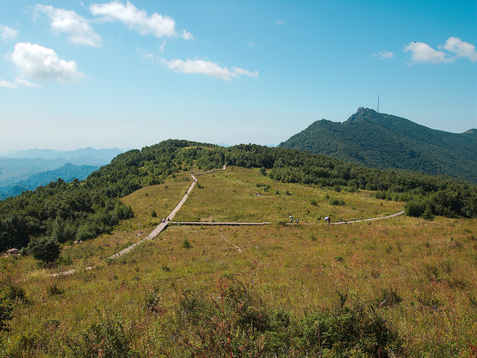
Mentougou, about three hours west, and the most unexpected landscape in the municipality. The summit plateau at around 2,000 metres is open alpine meadow — grass, wildflowers, boardwalk, and views over successive blue ridges to the west. In July and August it is genuinely covered in flowers, which is not something the rest of Beijing offers. Ten to fourteen kilometres depending on where you start. It is high enough that the weather changes quickly; take a windproof layer even in August.
Lingshan, the summit of Beijing
At 2,303 metres, Lingshan — Dongling Mountain — is the highest point in the municipality, on the Hebei border 120 kilometres west in Mentougou. There is a road, a service area, and a route to the main peak via Liulang Mountain in good condition, with a cable car and even horses available for part of the way. Walking it properly is twelve to sixteen kilometres with substantial ascent and takes a long day; the payoff is high grassland, cool air in midsummer and views across two provinces.
This is a car or organised-group destination — public transport is impractical — and it is worth checking access before setting out, as parts of the Lingshan area have been subject to conservation closures.
Shidu and Fangshan
South-west of the city, Shidu — “ten ferries” — is a limestone gorge on the Juma River, a completely different landscape of karst pinnacles and green water. It is reachable by suburban railway from Beijing West, which makes it one of the few genuinely accessible mountain destinations without a car. The walking is easy to moderate and the area is set up for rafting, bungee jumping and glass walkways, so expect infrastructure rather than wilderness. Good in spring and autumn; the river makes it bearable in summer.
Cuandixia and the western valleys
Cuandixia is a preserved Ming-dynasty stone village in a fold of the Mentougou hills, and the valley walks that radiate from it are gentle, pretty and almost entirely undocumented in English. Combine a couple of hours’ walking with a night in one of the village courtyard guesthouses and you have one of the better weekends available near Beijing.
Getting to the trailheads
This is the real constraint. Beijing’s public transport is excellent inside the city and thin at the edges of the municipality.
- Subway plus bus works for Xiangshan, Badachu and the near western hills. Cheap — under ¥20 a head — and slow.
- Suburban rail reaches Shidu from Beijing West and Yanqing from Beijing North. Infrequent but genuinely useful, and inexpensive.
- Long-distance bus serves Huairou, Miyun and Mentougou county towns, from which you need a local bus or taxi to the trailhead. Doable, but it usually costs you the early start.
- Private car and driver, ¥900–1,500 for a day. For anything beyond the near hills this is the practical option, and split between three or four people it is reasonable. Agree the pick-up point and time before you set off walking.
- Organised hiking groups. Several long-running operators in Beijing run weekend walks with transport included, typically ¥250–500 a head. For a visitor without a car and without Chinese, this is much the easiest way to reach a real trail, and the groups are a mix of expatriates and Beijing residents.
- DiDi works for the last leg from a county town but do not count on getting a car back from a remote trailhead in the late afternoon. Arrange the return before you start.
Conditions underfoot, and what to expect
Trails are not waymarked in the way European or American hikers expect. The managed scenic areas have stone steps and signage; everything else has paths made by use, occasional ribbons tied to branches, and no maps. Download an offline map before you go — Amap or Baidu Maps both work, and Google’s services are blocked.
Steps, not switchbacks. Chinese mountain paths tend to go straight up in stone staircases rather than traversing. This is harder on the knees and quicker on the ascent than most visitors expect. Poles help on the descent more than the climb.
Water and food. Managed areas have vendors; wild routes have nothing at all. Carry two litres in summer. There are no drinking fountains and no reliable resupply.
Toilets. At trailheads and scenic-area entrances, and nowhere else.
Phone signal is surprisingly good on ridges and unreliable in valleys. Emergency number is 110 for police, 120 for an ambulance, and getting a casualty off a remote ridge is slow.
Wildlife is not a serious concern. Snakes exist and are mostly harmless; ticks are present in long grass in summer; there are no large predators. Wasps in late summer are the most common cause of trouble.
Season by season
Spring, March to May
The hills green up in April and the blossom in the western valleys is genuinely good. The problem is dust — Gobi sandstorms can cut visibility for days at a time between March and May, and the haze between events is worse than autumn’s. Pleasant temperatures, though, and few people.
Summer, June to August
Hot and humid on the plain, which is exactly why the high routes come into their own — Baihua and Lingshan are ten degrees cooler than the city and the meadow flowers are at their best. The complications are thunderstorms, which build fast on summer afternoons, and the rainy season in late July and August, when trails become slippery and flash flooding in gorges is a genuine hazard. Start early, be off exposed ridges by mid-afternoon, and do not enter a narrow valley when rain is forecast upstream.
Autumn, September to November
The best season, without much argument. Dry, clear, stable, with autumn colour from mid-October and the year’s best visibility. Avoid 1–7 October, when Golden Week fills every accessible trail. The first two weeks of November are cold, empty and superb.
Winter, December to February
Cold, dry, bright and very quiet. The Great Wall routes are perfectly walkable in winter and the visibility is often the best of the year, but stone steps hold ice in shaded sections and a fall on a wall staircase is serious. Microspikes are worth carrying. Some scenic areas close routes entirely; check before travelling. The winter guide covers what the season is like more broadly.
Air quality and hiking
Worth checking before any long day out, though far less of an issue than it once was — Beijing’s annual average PM2.5 fell to a record 27 µg/m³ in 2025 and heavy-pollution days are now rare. As a rule of thumb, anything under AQI 100 is fine for a full hiking day. Between 100 and 150, shorten it. Over 150, stay in the city, both because hard exercise multiplies your exposure and because the long ridge views that justify the journey will have vanished into grey. Summer brings a second consideration: ozone peaks on hot sunny afternoons between about 2pm and 6pm, which is another argument for an early start. The air quality guide covers the readings in more detail.
What to take
- Boots with real grip. Worn stone is slippery and the wild Wall is loose underfoot.
- Two litres of water minimum in warm weather, more for the high routes.
- An offline map on your phone, downloaded before you leave the city, plus a power bank.
- A windproof layer even in summer — the high meadows are exposed and much cooler than the forecast for Beijing suggests.
- Sun protection. The Wall and the summit meadows have no shade at all.
- Cash as a backup. Alipay and WeChat Pay work almost everywhere, but a village shop three hours out is the one place where a hundred-yuan note still solves a problem.
- Poles, if your knees dislike stone staircases. They will.
- Microspikes in winter for icy steps.
Check that your your insurance covers hiking — some policies exclude it above a certain altitude or on unmarked routes, which describes most of what is worth walking here.
Two-day options
If a single day feels like a lot of driving for a few hours of walking, several routes work better with a night out:
- Camping on the Wall with a licensed operator at Gubeikou or Jiankou, ¥600–1,200 a head including transport, food and kit. You watch the sun set and rise from a watchtower. The camping guide covers the operators.
- A guesthouse at Jinshanling village or Gubeikou, ¥200–450, letting you walk the traverse at dawn.
- Cuandixia, staying in a Ming courtyard house and walking the valleys either side.
- Gubei Water Town beneath Simatai, if you want a comfortable base and do not mind that the village is purpose-built.
What is not really a hike
- Badaling. A restored wall section with a cable car and a crowd. Fine as a sight; not a walk.
- The Fragrant Hills chairlift. If you take it both ways you have had a nice view and no exercise, which is a legitimate choice but let us call it what it is.
- Longqing Gorge. Spectacular, and you see it from a boat and a series of escalators inside the dam. Not walking.
- Most “hiking” day tours from central Beijing. Check the actual distance before booking. A number advertise a Great Wall hike that amounts to two kilometres on a restored section.
- The Olympic Forest Park. Good for a run, flat, and about as mountainous as Hyde Park.
Frequently asked questions
Where is the best hiking near Beijing?
The unrestored Great Wall, for long-distance walking with a view — Gubeikou to Jinshanling for moderate fitness, Jiankou to Mutianyu for the hard version with a guide. For mountains without the Wall, Yunmeng Mountain in Miyun and Baihua Mountain in Mentougou, whose summit meadow at around 2,000 metres is the most unexpected landscape near the city.
What is the highest mountain in Beijing?
Lingshan, also called Dongling Mountain, at 2,303 metres, in Mentougou District about 120 kilometres west of the centre. Haituo Mountain at 2,241 metres in Yanqing is second, and Mount Wuling at 2,118 metres sits on the Miyun–Hebei border. Check access before travelling; parts of the Lingshan area have been closed for conservation at times.
Can I hike near Beijing without a car?
For the near western hills, yes — subway and bus reach Xiangshan and Badachu, and suburban rail reaches Shidu and Yanqing. For anything further, public transport usually costs you the early start. A private driver at ¥900–1,500 for the day, or an organised hiking group at ¥250–500 a head with transport included, are the practical options.
Is Fragrant Hills a real hike?
Not in the way most people mean. It is a well-made stone staircase to a 557-metre summit, with pavilions, tea stalls and a chairlift alongside. It is a pleasant wooded walk with a view. In the third and fourth weeks of October the red leaves draw enormous crowds; go on a weekday or a fortnight either side.
Are the trails waymarked?
Managed scenic areas have steps and signs. Everything else has paths made by use and occasional ribbons on branches. Download an offline map — Amap or Baidu Maps — before you leave the city, because Google’s services are blocked in China.
When is the best time of year?
Late September through early November: dry, clear, stable weather with the best visibility of the year and autumn colour from mid-October. Avoid Golden Week, 1–7 October. Summer is good for the high routes, which are much cooler than the city, but watch for afternoon thunderstorms and flash flooding in gorges.
Is it safe to hike alone?
On the managed routes and the Gubeikou traverse, yes, with normal precautions. On Jiankou, no — go with a guide or at minimum a companion. Phone signal is good on ridges and poor in valleys, rescue is slow, and the risk on unrestored wall is real rather than theoretical.
Do I need permits?
Not for ordinary walking. Scenic areas charge an entrance fee, typically ¥30–80. Some sections of the Wall are formally closed or under military control and should not be entered — the marked detour on the Gubeikou route exists for that reason.
How bad is the air for hiking?
Much better than the reputation. Under AQI 100 is fine for a full day; between 100 and 150 shorten the walk; over 150 stay in the city. Beijing’s annual PM2.5 average hit a record low of 27 µg/m³ in 2025 and heavy-pollution days are now very rare, though summer afternoons bring an ozone peak that argues for early starts.
Are there guided hiking groups in Beijing?
Yes. Several long-established operators run weekend walks with transport from the city, typically ¥250–500 a head, on routes ranging from easy valley walks to the full Jiankou traverse. For a visitor without a car or Chinese, this is by far the easiest way onto a real trail.
Can I camp?
Legally, on the Great Wall with a licensed operator, at ¥600–1,200 a head including transport, food and kit at Gubeikou or Jiankou. Wild camping elsewhere in the municipality sits in a grey area and is restricted in protected scenic areas, so use an operator rather than improvising.